You think you’re safe because a government map says you are. Then two feet of water smashes through your living room window.
That’s exactly what happened to hundreds of families across northern Michigan this spring. Record-breaking April rains poured onto record-setting March snowfall. The result was a historic deluge that overwhelmed dams, washed out highways, and left thousands of homeowners financially ruined.
The worst part is that many of these residents had no idea they were even at risk. They didn't have flood insurance because they were told they didn't need it.
This crisis exposed a glaring problem with how the United States measures and communicates disaster risk. Rural communities are being left completely in the dark. Outdated methods, severe understaffing, and bureaucratic gaps mean that if you live outside a major metropolitan area, your official flood risk profile is likely a work of fiction.
The Illusion of Safety in Unmapped Counties
When Tom and Diane Peterman moved to their retirement home on Black Lake fourteen years ago, they tried to buy flood insurance. They were told it wasn't available. Other neighbors, like John Solum, were explicitly told their homes sat outside any danger zones.
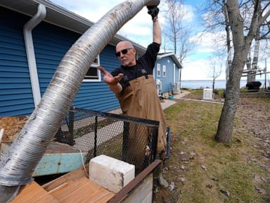
Then the spring thaw hit. Black Lake rose so high that floating ice sheets literally broke apart decks and shattered windows. Knee-high water flooded interiors, forcing families to rip out drywall, flooring, and everything they owned.
Why weren't they prepared? The answer lies in a map that doesn't exist.
Black Lake straddles two different Michigan counties. Cheboygan County has a Federal Emergency Management Agency flood plain map from 2012. Presque Isle County, where most of the damage occurred, has never been mapped by the federal government.
This isn't an isolated fluke. FEMA develops the maps that determine who lives in a high-risk flood plain. These maps dictate who must buy insurance and help local towns plan their infrastructure. But the agency historically prioritizes high-population areas to get the most bang for its buck. It makes sense on paper when budgets are tight. In reality, it leaves roughly two-thirds of the nation's streams, rivers, and coastlines completely unmapped.
If there is no map, the system assumes there is no danger. This creates a false sense of security that ruins lives.
Why Federal Flood Models Fail Rural America
Even when a rural area actually has a map, the data is frequently dangerously out of date. Some maps used across the country are decades old. They rely entirely on historical statistics. They look backward, treating the weather patterns of the 1980s as the baseline for the realities of 2026.
The math behind these models is broken because the atmosphere has changed. A warmer atmosphere holds significantly more moisture. This sets the stage for rapid, intense dumps of rain and snow.
This spring, an unusually warm Gulf of Mexico pumped massive amounts of moisture into the Upper Midwest. Northern Michigan got hammered with two to four feet of snow in March. Right after that, record-breaking April rains triggered massive runoff. The local ground was already saturated or frozen. Waterways, small dams, and old culverts simply couldn't handle the volume.
Richard Rood, a climate scientist at the University of Michigan, points out that calling these storms "historic" is misleading. They are only historic compared to the past. They are rapidly becoming typical for our future.
Waterways Versus Rainfall
There is another massive blind spot in federal mapping. FEMA focuses almost exclusively on riverine flooding. They measure what happens when a river, stream, or lake overflows its banks.
They don't properly account for pluvial flooding. That’s the technical term for flooding caused strictly by intense rainfall that accumulates faster than the ground or local infrastructure can drain it away.
When a massive storm drops inches of water onto a rural town, it doesn't matter if you live near a river. The water stacks up on roads, fields, and yards because there is nowhere for it to go. Your basement floods anyway. Because FEMA maps don't capture this rainfall-driven risk, millions of Americans are exposed to danger without warning.
Private climate research groups are trying to fill this information gap. First Street Foundation analyzed nationwide risk by incorporating modern rainfall data and mapping smaller streams that federal agencies ignore. Their models discovered more than twice the number of properties at significant flood risk nationwide compared to federal estimates. In Michigan alone, their data showed four times as many properties are vulnerable than what official federal records claim.
A Broken Agency Facing Severe Shortfalls
Fixing this problem is incredibly expensive and slow. The Association of State Floodplain Managers estimates that fully mapping the entire United States would cost between $4 billion and $12 billion. FEMA has never received that kind of funding from Congress.
Compounding the budget issue is an unprecedented human resources crisis. A General Accounting Office report revealed that FEMA lost nearly 20% of its total workforce in 2025 alone. Even more alarming, the agency lost roughly 25% of its permanent, most senior staff.
Christopher Currie, who audits FEMA for the GAO, has voiced immense concern over these numbers. The agency was already struggling to keep up with its mapping mandates. Now, a depleted workforce must constantly divert attention and personnel away from long-term planning and mapping to respond to an escalating cycle of active disasters.
When a hurricane hits or a major metropolitan area floods, personnel get reassigned. The quiet work of mapping a rural county in Michigan or Wisconsin gets pushed to the bottom of the pile.
The National Flood Insurance Program Blind Spot
The lack of maps leads directly to a lack of insurance participation. To buy a flood insurance policy underwritten by the federal government, your local community must first participate in the National Flood Insurance Program.
Matthew Occhipinti, Michigan’s coordinator for the insurance program, noted that several hundred communities across the state have never joined. Many of these towns have no history of major disasters, so local leaders see no reason to sign up. Others simply don't understand how the program functions.
Communities can technically participate in the program even if they don't have an official FEMA map. But without that visual tool, residents don't buy policies.
The Flaw of the National Risk Index
When local officials try to look up their vulnerabilities, they often rely on a tool called the National Risk Index. This is a separate digital portal maintained by the government to give communities an overall score for disaster risk.
The index has a fatal structural flaw. If a community lacks an official flood plain map, the index automatically scores its flood risk as zero. It treats an absence of data as an absence of danger.
A rural town might check the index, see a low overall risk score, and assume they are perfectly fine. Homeowners buy houses, banks issue mortgages without requiring flood coverage, and everyone stays happy until the water starts rising.
Taking Control of Your Own Flood Risk Assessment
You cannot wait for a federal agency to update a map to protect your property. If you live in a rural area, you have to look beyond official government declarations to figure out your actual exposure.
First, look at alternative data sources. Platforms like Risk Factor, which uses data from the First Street Foundation, allow you to type in your specific address to see climate-adjusted risks. It includes rainfall flooding models that the federal government leaves out.
Second, pay attention to local topography rather than just proximity to major bodies of water. Look at how water flows across your property during a standard heavy thunderstorm. Are there culverts nearby? Are they clear of debris? Do your local roads act as channels for runoff?
Talk to older neighbors who have lived in the area for decades. Ask them where the water went during the worst storms they can remember. Local oral history is often far more accurate than a fifteen-year-old computer model run by an agency located hundreds of miles away.
Practical Steps to Protect Uninsured Properties
If you discover your property is vulnerable and you can't access traditional federal flood insurance, you still have options to mitigate damage.
- Look into private flood insurance markets. While it used to be incredibly rare, more private insurers are writing policies using modern climate models. It can be more expensive, but it beats paying 100% of a rebuild out of pocket.
- Implement dry floodproofing measures. Install heavy-duty sump pumps with reliable battery backups. If the power goes out during a major storm, a standard electric pump is useless.
- Elevate critical utilities. Move your furnace, water heater, and electrical panels well above the floor level of your basement or crawl space.
- Install backflow check valves in your plumbing traps. When stormwater systems or local ditches overwhelm, water can back up directly through your drains and into your home. A simple valve stops this from happening.
- Regrade the soil around your foundation. Ensure the ground slopes sharply away from your house for at least six feet. Clean your gutters frequently and extend downspouts far away from your walls.
The spring disasters in Michigan proved that standard statistical averages don't dictate reality anymore. Relying on an official government map to decide whether you need to prepare is a dangerous gamble. Take steps now to analyze your space, fortify your structure, and secure whatever private protection you can find before the next historic storm arrives.