The identification of extensive, relict subseafloor permafrost beneath the Labrador Sea disrupts established thermal models of marine sediments and exposes a systemic vulnerability in Arctic infrastructure planning. For decades, offshore geotechnical risk assessments have relied on a critical assumption: that sub-zero marine sediments are predominantly unfrozen due to high salinity and the thermal insulation of the overlying ocean. Data from the Labrador seafloor invalidates this baseline. This geographical anomaly highlights a profound misalignment between current predictive permafrost models and physical reality, with immediate economic and structural consequences for subsea cabling, pipeline routing, and carbon sequestration initiatives.
The presence of this subseafloor permafrost cannot be treated as an isolated geological curiosity. Instead, it must be analyzed as the output of a complex thermodynamic system governed by past glacial cycles, sedimentation rates, and current benthic boundary layer temperatures. Resolving the variance between existing maps and actual seafloor conditions requires dismantling the binary "frozen vs. unfrozen" classification system and replacing it with a rigorous, state-variable framework that accounts for the phase-change mechanics of pore waters under high hydrostatic pressure.
The Tri-Factor Mechanical Matrix of Subseafloor Permafrost
To understand why traditional mapping models failed to predict the Labrador Sea formations, the system must be broken down into three interdependent variables. These variables dictate the creation, preservation, and eventual degradation of subsea cryospheric structures.
1. Relict Thermal Inertia and Transgressive Submergence
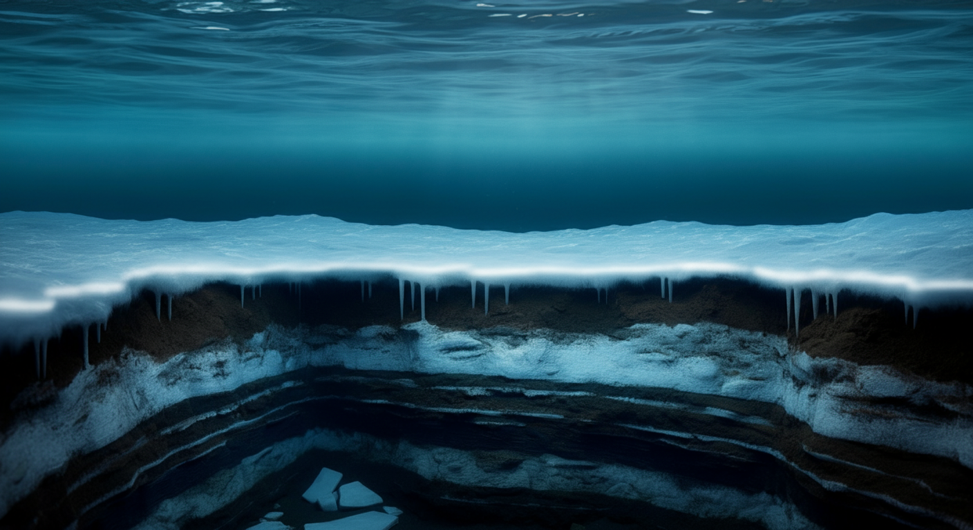
Subseafloor permafrost is primarily a relict feature. During the Last Glacial Maximum, vast areas of the continental shelves were subaerially exposed to sub-zero atmospheric temperatures, allowing deep permafrost aggradation to occur. Subsequent post-glacial marine transgression submerged these landscapes.
The survival of this permafrost depends on a race between thermal diffusion and sediment depth. Sea water, even when near 0°C, acts as a heat source relative to deep, sub-zero permafrost. The rate of degradation is governed by Fourier’s Law of Heat Conduction:
$$q = -k \nabla T$$
Where:
- $q$ is the heat flux,
- $k$ is the thermal conductivity of the sediment matrix,
- $\nabla T$ is the temperature gradient between the warming seafloor and the deep permafrost core.
Because marine sediments often possess low thermal conductivity, thick layers of post-glacial silt act as a thermal blanket, slowing down the penetration of marine heat and preserving the underlying frozen state for millennia.
2. Hydrostatic Pressure and Salinity Depression of the Freezing Point
The primary flaw in early remote-sensing and seismic interpretation models was the miscalculation of the pore-water freezing point. In a marine environment, water does not freeze at 0°C. Two primary depressants are at play: chemical composition (salinity) and mechanical force (hydrostatic pressure).
[Hydrostatic Pressure Increase] + [Salinity Concentration]
                           │
                           ▼
          [Freezing Point Depression ΔT_f]
                           │
                           ▼
    [Suppression of Ice Crystal Nucleation in Pores]
The phase equilibrium of pore water is shifted downward by the concentration of dissolved ions (primarily $Na^+$ and $Cl^-$). As ice forms, salt is excluded from the crystal lattice, concentrating the remaining brine in the pore spaces and further lowering the freezing point of the residual liquid. Concurrently, high hydrostatic pressure from the overlying water column alters the Gibbs free energy of the system, requiring significantly lower temperatures to initiate ice crystal nucleation. Models that fail to dynamically calculate this shifting phase boundary routinely misclassify frozen, high-ice-content sediments as unfrozen, high-salinity muds.
3. Lithological Composition and Capillary Pressure Effects
The physical matrix of the sediment determines its capacity to hold ice under thermal stress. Fine-grained sediments, such as clays and silts found in deep-water basins like the Labrador Sea, introduce capillary forces that further complicate phase changes.
Within narrow pore throats, the curvature of the ice-water interface generates a high capillary pressure. This pressure suppresses the freezing point beyond the effects of salinity and hydrostatic pressure alone. Conversely, these fine-grained matrices exhibit low permeability, which restricts the migration of warm, saline seawater into the formation. This prevents convective heat transfer, forcing the system to rely entirely on slow conductive warming, which preserves the frozen core.
Quantifying the Failure Modes of Conventional Mapping Frameworks
The discrepancy between historical permafrost maps and the physical realities discovered beneath the Labrador Sea stems from a reliance on indirect proxies and outdated interpolation techniques. The standard mapping stack suffers from three distinct structural failures.
The Seismic Interpretation Bottleneck
Acoustic profiles of the seafloor rely on changes in acoustic impedance—the product of seismic wave velocity and material density—to map sub-surface layers. Historically, a sharp increase in compressive wave ($P$-wave) velocity was interpreted as the definitive boundary of permafrost, as ice exhibits a significantly higher seismic velocity than unfrozen sediment or water.
This methodology breaks down in deep-water environments. High-pressure, low-temperature zones favor the formation of gas hydrates, which exhibit acoustic impedance signatures nearly identical to those of ice-bearing permafrost. Lacking direct physical sampling, geophysicists routinely misidentified subseafloor permafrost as methane clathrates, completely erasing the frozen sediment footprint from regional maps. Furthermore, partially frozen sediments—where pore water exists as a slush or highly concentrated brine alongside ice crystals—do not produce a clean acoustic reflection, rendering them invisible to standard sub-bottom profiling tools.
Thermal Equilibrium Bias in Climatic Models
Many macro-level permafrost maps are built on the assumption of long-term thermodynamic equilibrium. These models feed historical atmospheric data into shallow thermal conduction equations, assuming that the seafloor has fully adjusted to modern ocean temperatures.
This approach ignores geological latency. The thermal regime of the Labrador seafloor is fundamentally transient, not static. The deep subsurface is still responding to the thermal inputs of the early Holocene transgression. By assuming equilibrium, conventional models overestimate the rate of subseafloor thawing by orders of magnitude, predicting total degradation where deep, structurally sound permafrost cores actually remain.
The Spatial Data Gap
The density of physical geotechnical boreholes in the Arctic and sub-Arctic marine environment is remarkably low due to the extreme capital costs of high-latitude drilling. Geostatistical models attempt to bridge these gaps using kriging and other spatial interpolation methods over hundreds of kilometers. This statistical smoothing erases localized geological anomalies. Sub-marine channels, localized sedimentation events, and ancient river deltas—which dictate the preservation or destruction of permafrost—are completely flattened out in the macro-models, resulting in broad, unvalidated assertions of a completely thawed seafloor.
Geotechnical and Strategic Infrastructure Implications
The realization that subseafloor permafrost exists in regions previously classified as thawed introduces immediate structural risks to marine engineering. Operating blind to these formations creates a high-probability failure pathway for energy, communication, and environmental assets.
| Engineering Domain | Assumed Baseline Condition | Actual Permafrost Reality | Structural Consequence / Failure Mode |
|---|---|---|---|
| High-Voltage Subsea Cabling | Homogeneous, consolidated, unfrozen marine sediments with stable thermal conductivity. | Intermittent ice-bearing silt lenses prone to rapid thermal alteration via cable heat dissipation. | Thermal runaway, cable sagging, localized sediment liquefaction, and eventual structural shear. |
| Pipeline Routing & Anchoring | Structurally stable, friction-dominated seabed allowing standard gravity anchoring. | Ice-rich, bonded sediments highly susceptible to thaw-induced consolidation when subjected to heated product flow. | Differential settlement, loss of anchor lateral load capacity, pipeline buckling, and catastrophic rupture. |
| Carbon Capture & Sequestration | Permeable sandstone reservoirs sealed by standard, non-cryogenic caprock formations. | Unstable, temperature-sensitive permafrost barriers acting as temporary, fragile seals for shallow gas. | Thaw-mediated caprock breach, leading to rapid migration and atmospheric escape of sequestered $CO_2$. |
The Mechanism of Thaw Consolidation
The most severe engineering threat posed by unmapped subseafloor permafrost is thaw consolidation. When ice-bearing sediments are subjected to thermal loads—such as the heat radiated from a buried high-voltage direct current (HVDC) cable or a warm oil pipeline—the internal ice melts.
Because ice occupies roughly 9% more volume than liquid water, and because fine-grained sediments are often ice-segregated (containing pure ice lenses), melting creates an immediate excess pore water pressure. If the permeability of the surrounding sediment is low, this water cannot escape rapidly. The excess pressure transfers the structural load away from the mineral grains and onto the liquid pore water, reducing the effective shear strength of the soil to zero. The sediment undergoes sudden, catastrophic liquefaction, causing any infrastructure anchored within or resting upon it to sink, tilt, or shear apart under its own weight.
A Calibrated Blueprint for Next-Generation Cryospheric Mapping
Correcting the errors exposed by the Labrador Sea data requires an immediate transition away from purely empirical, interpolation-based mapping toward a dynamic, physics-informed data collection and modeling paradigm.
       [Raw Acoustic & Seismic Hydrophone Arrays]
                           │
                           ▼
  [Inversion of Multi-Frequency Shear Wave V_s Velocity]
                           │
                           ▼
 [Physics-Informed Neural Networks (PINNs) / Navier-Stokes]
                           │
                           ▼
  [Dynamic Cryospheric State Map (Ice Saturation / Shear)]
1. Multi-Frequency Shear-Wave ($V_s$) Inversion Protocols
Compressional wave data is insufficient for distinguishing between gas hydrates, highly lithified sediments, and true permafrost. Marine survey frameworks must mandate the deployment of multi-frequency shear-wave ($V_s$) velocity profiling.
Water cannot sustain shear stress; therefore, the shear wave velocity of an unfrozen, water-saturated sediment is exceptionally low, governed entirely by the skeleton of the sediment grains. When ice forms within the pore space, it binds the grain matrix together, causing an exponential increase in $V_s$. By cross-referencing $P$-wave and $V_s$ profiles, geotechnicians can isolate the exact volume fraction of pore ice, eliminating the false positives generated by methane hydrates or dense clay formations.
2. Integration of Physics-Informed Neural Networks (PINNs)
Statistical interpolation must be replaced with Physics-Informed Neural Networks (PINNs). These computational frameworks do not merely interpolate data points across empty spatial coordinates; they constrain their predictions using fundamental thermodynamic and fluid dynamics equations.
A PINN modeling a subseafloor domain is bound by conservation of energy, Darcy’s law for fluid flow through porous media, and the phase-change kinetics of saline solutions. When presented with sparse borehole data and regional bathymetry, the network solves for the most physically plausible subsurface thermal distribution, accurately capturing localized preservation zones that standard statistical models smooth over.
3. Systematic In-Situ Thermal CPTu Deployment
Remote sensing must be validated by targeted, in-situ physical testing. The deployment of piezocone penetrators equipped with precision thermal sensors (Thermal CPTu) must become standard practice along proposed infrastructure corridors.
As the cone is advanced into the sediment, it measures tip resistance, sleeve friction, pore water pressure, and localized dissipation rates. Ice-bonded sediments exhibit highly distinct mechanical resistance signatures coupled with rapid thermal drawdown. This data provides the direct physical calibration required to tune seismic inversion algorithms and update macro-level regional maps.
Strategic Re-Alignment for High-Latitude Asset Deployment
Asset managers, infrastructure developers, and regulatory bodies cannot afford to treat subseafloor permafrost as a distant environmental concern. The empirical evidence from the Labrador Sea demonstrates that the cryospheric boundaries are poorly understood and structurally volatile.
The immediate tactical mandate for any marine deployment in latitudes above 50° North is to enforce a strict risk-mitigation protocol prior to asset design authorization:
- Audit Historical Data Stacks: Reject any environmental impact assessment or geotechnical routing plan that relies on pre-2020 regional permafrost maps. These models are fundamentally compromised by thermal equilibrium bias and the misclassification of acoustic impedance anomalies.
- Implement Dynamic Thermal Modeling: Require all engineering designs for subsea assets to run transient thermal simulations over a minimum 50-year operational lifecycle. These simulations must factor in the continuous heat output of the asset against a changing benthic boundary layer temperature, accounting for the localized thaw-consolidation potential of the sediment matrix.
- Redesign Foundation Protocols: Where the elimination of permafrost contact is impossible due to routing constraints, abandon standard gravity anchors and shallow burial methods. Shift instead to deep-piled foundations or actively cooled anchoring systems capable of maintaining thermal stability in the surrounding sediment matrix, isolating the structural load from the volatile pore-water phase boundary.
The cost of executing high-resolution, multi-wave seismic surveys and physical thermal testing is substantial. However, it represents a fraction of the capital expenditure required to remediate a fractured subsea pipeline or a ruptured trans-oceanic data link experiencing structural failure due to unmapped sediment liquefaction. The Labrador Sea findings are an early warning signal; the market will reward those organizations that adjust their risk metrics to match the physical reality of the subsea Arctic.